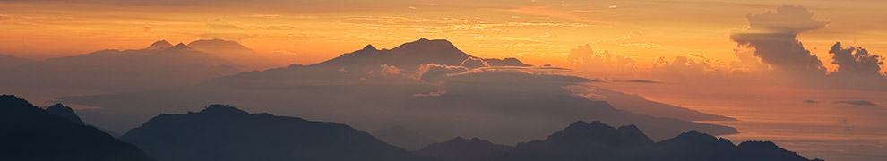
Tag Archives: SECA

Future Landscapes VII: Flight

Pelican Flight

Pelican Flight

This image is a composite of two photographs. The background was taken inland from Merimbula, during a day of preventative back-burning. Dense smoke clouds emerged from many locations in the forest (part of the Southeast Forests National Park) and wafted over the treetops and nearby rural properties. There was a strong smell of smoky eucalyptus, and the atmosphere was lit with a glowing golden-brown haze. The pelican was photographed several hundred kilometres away (and several months earlier) in sunset light at Marlo in Gippsland. I processed both images with extra-warm white balance (about 6500oK), and applied some graininess to both images to accentuate the gritty sepia tonings.

I was thinking at the time of the impact of human intervention into the landscape, and the drastic changes that this has brought to the life of birds and animals of the region. I imagined the pelican fleeing the terror of the fire, and looking (accusingly?) out of the frame at the viewer. The same concept motivated the Echidna flight and Humpback flight images.

Echidna Flight

Echidna Flight

The background image depicts the Princes Highway near Merimbula, at the junction with the Yellow Pinch Road. It was taken in an autumn mid-afternoon, during burning-off operations in the adjacent forest. The light through the trees was filtered by the smoke, which also produced a hazy coppery light, almost (but not quite) like the warm light of sunset. The echidna was photographed a little before dawn (the following day), at Haycock Point in the Ben Boyd National Park, south of Pambula. Uncharacteristically for echidnas, he (or she?) seemed relatively unperturbed by my presence, and posed happily for some photographs before ambling away.

Like the Pelican flight image, this composite image was inspired by my thoughts of ‘wildlife’ fleeing from human disruption of their habitat. The massive size of this ‘mega-fauna monotreme’ is intended to suggest that it not just an individual creature, but is somehow representative of the species, or of native creatures in general.

Humpback Flight

Humpback Flight

A three-image composite. One of them – the background of ocean and sky – is itself based on another five separate images, combined as a high-dynamic range (HDR) image to give the scene a more dramatic, graphic sort of look. This was taken in early morning light in the Ben Boyd National Park. The ‘road’ is actually a wharf, extracted from a picture of the Edrom Point naval facility on Twofold Bay. Although humpback whales are seasonally prolific along the far south coast of NSW, I was in the region during autumn, when they are not around. So the whale in this image is one that I photographed in June 2012 in King George Sound, near Albany, Western Australia.

There can be few sights in nature as powerfully exhilarating as the sight of a breaching whale. After the near-extinction of many whale species during the 19th and 20th century commercial whaling, whale numbers are strongly recovering in the region. Twofold Bay was the site of a number of whaling stations, which operated until the last one (Davidson’s) ceased in 1929. Now the boats head out from Snug Cove at Eden for the purpose of watching (rather than catching) whales.

As with the other ‘Flight’ images (Echidna flight, Pelican flight) I wanted to allude to the disruption of habitat by human activity. In this instance the whale’s exultant launch into the air looks to be heading for a hard landing.

Future Landscapes VI: Eden Washovers

Edrom Wharf Washover

Edrom Wharf Washover

I’m not sure whether to view this image as a still frame from an over-the-top disaster movie, as a piece of subtle-as-a-sledgehammer environmental propaganda, or just as a visually interesting play on the fact that climate change will increase the likelihood of ‘washover events’ and coastal inundation as sea levels rise. In any event the small figures which can be seen at the far end of the road bridge should probably be running in terror from the approaching wave, rather than standing there casually fishing.

The road bridge is extracted from a photograph of the naval wharf at Edrom Point – the same one as seen submerged in Humpback flight. The wave was photographed at Depot Beach (north of Bateman’s Bay) where, when the swell is big enough and when the tide is right, the waves wrap around a small island off the headland and produce marvellous interference patterns as they collide.

Eden Washover I

Eden Washover I

Behind Aslings Beach in the town of Eden, a fairly low dune protects Lake Curalo and the lower parts of the town from inundation by the sea. If the dune were to be breached by the surf – which is more likely with rising sea levels and greater incidence of extreme weather events – one of the first areas to be inundated would be the sports field of the High School.

This composite image gives a fanciful vision of such a ‘washover event’, replacing the gentle lakeside view behind the football field with a turbulent set of ocean waves from Depot Beach.

The ‘Maritime Security Level’ sign, which I have relocated from the entrance to the Edrom Point naval wharf, assumes a new meaning for ‘security’.

Eden Washover II

Eden Washover II

The Eden Cemetery is located just on the town side of the Aslings Beach sand dune. It contains many graves from the 19th Century, the oldest known being from 1834. Some of the oldest graves now lie below the road which was constructed along the top of the consolidated dune.

The inscriptions are indicative of the difficulties of life for the early settlers and mariners of the region, with many drownings: “who departed this life at sea”, “died at sea on her passage from Launceston”, “my dear husband and children, drowned at Eden”.

If the Aslings Beach dune were to be breached by the sea in a ‘washover event”, the ocean could claim them for a second time. This composite picture imagines the lower parts of the cemetery under water, with fresh sand banks amongst the graves.

Future Landscapes V: Miscellany

Report and Reality

Report and Reality

The waters of Pambula Lake join with the ocean through a narrow inlet which runs between Pambula Beach and Haycock Point. There are large shell middens still clearly visible alongside the channel. In the pre-dawn light the still surface of the inlet, spotted with patches of seaweed showing through at low tide, looks as though one could walk across it.

I’ve overlaid the water surface with words and graphic extracted from the final report on South East Coastal Adaptation (SECA): Coastal Urban Climate Futures in SE Australia from Wollongong to Lakes Entrance: a map, a graphs of population projections for the region, arrows and words from the academic vocabulary in which the report is written (“Coastal Urban Futures”, “Time horizon”. The idea was to juxtapose the rhetoric of the report with the physical reality of the landscape.

The Garden of Eden

The Garden of Eden

Apart from its biblical importance, The Garden of Eden is a large caravan and camping park in Eden. This marvellously named establishment does indeed have a ‘Pets Welcome’ sign at its gate (though one wonders whether snakes would be admitted).

Inland from Eden, high up in the Southeast Forests along the Coolangubra Forest Road, a different kind of garden is seen in the extensive clearfell logging coupes. I’ve combined the two images to construct a dystopian vision of a paradise.

The green forest sign (“Woodchipped to promote sawlog growth”) has been transported from another, rather more healthy-looking forest location (alongside the Princes Highway), to add a touch of irony.

Future Landscapes IV: Fisheries

Fishery Sunset

Fishery Sunset

A large ‘hazard reduction’ fire was burning on the slopes of Mt Imlay, and a light southerly wind blew the smoke clouds up past Eden. As a result, the sunset light from the Snug Cove wharf was particularly spectacular, with light the colour of blood oranges.

I was on the wharf to photograph the trawlers and other boats moored there. This photo looks through the silhouetted masts of one of the larger trawlers towards the sunset. Superimposed on the sky are images of fish of the region, taken from a sign (at Quarantine Bay) which advises recreational fishermen of the size and bag limits for each of the various species.

Greenseas Cannery

Greenseas Cannery

The Greenseas Tuna Cannery operated at Cattle Bay in Eden for 50 years until 1999. Its closure by the owners (Heinz) was a serious blow to the community, as it had been the town’s major employer, and a ready market for the local fishing fleet. It’s now a derelict site, fenced off to prevent public access, with mostly just concrete slabs remaining, in a picturesque location beside the bay.

Into this setting (using 3D objects created in Photoshop CS6) I placed two large panels like advertising billboards, displaying images of the coastline at Pinnacles Point, in Ben Boyd National Park.

One picture conceals the ugliness of the remaining ruined factory building, while the other prevents us from seeing the ‘natural’ scene of the harbour behind. Perhaps the images are preferable to, or more desirable than, reality?

Future Landscapes III: Mallacoota Washovers

Mallacoota Washover I

Mallacoota Washover I

The base photograph for this image was taken in Mallacoota, looking across the Genoa River inlet towards the ocean. Large numbers of pelicans frequent the area, attracted in part by the fish cleaning benches at the public boat launching ramp. Two them are seen to be taking off, in their ungainly way.

The overlayed bridge appears to have been immersed by the waters of the inlet, suggesting this to be a flooded place of human occupation.

Mallacoota Washover II

Mallacoota Washover II

At the Mallacoota Inlet, a complex system of sandbanks defines the passage of the Genoa River as it reaches the ocean, near the conjunction of Bass Strait with the Tasman Sea. At low tide the shallow platforms of sand emerge from the waters of the Inlet.

In this image I wanted to transform the view from a tidal landscape to a scene suggestive of future inundation, by placing a semi-derelict building and surrounding garden plants onto the sandbank. Surely it will be immersed by the next high tide. A lone figure with a small boat is seen departing – perhaps salvaging some last possessions?

The little building was actually photographed in a (dry) paddock alongside the road out to Pambula Beach in NSW.

Ghost Gums

Ghost Gums

The base photograph was taken in early morning light at Mallacoota, looking westwards across the waters of the inlet.

The photograph of the ‘ghost gums’ was taken along the Broadaxe forestry road through the Southeast Forests, near the Victorian border.

These trees, seen below the water of the inlet appear impossible – credible neither as a reflection or a submersion of a real forest. The perspective is ‘wrong’ in a way that disrupts the viewing of it as a conventional landscape. I wanted the image to evoke a mood with equal measures of serenity, melancholy and strangeness.

Future Landscapes II: Seascape minus…

Seascape Minus Chip Mill

Seascape Minus Chip Mill

The woodchip mill on the southern end of Twofold Bay (at Edrom Point) is operated by South East Fibre Exports (formerly Harris-Daishowa), a subsidiary of Nippon Paper Industries. Despite declining production due to the high value of the A$, economic problems in Japan, and cheaper alternatives in other countries, forestry remains a significant employer in the region – and a major contributor to the local economy.

The facility itself isn’t open to the public, but you can get a good view of it from the adjacent large naval wharf (built in 2003, primarily to load naval vessels with munitions from the Explosives Ordnance facility on Edrom Road).

The future of the woodchip mill and its associated bulk loading terminal is uncertain. This image imagines a future landscape in which all traces of pulp mill at Edrom Point have disappeared, and the site has been fully ‘remediated’. The evidence of the site’s former purpose now only exists in the form of an image on a flag which billows overhead.

Seascape Minus Fish

Seascape Minus Fish

As with the Seascape minus chip mill image, this picture was taken on the naval wharf at Edrom Point, on the southern shore of Twofold Bay. The background shows the huge piles of wood chips stockpiled at the SEFE mill and bulk loading terminal.

In the foreground, on the railing of the wharf, is a chart to advise recreational fishers of the size and bag limits for each of the fish species found locally.

The image imagines a future in which many of those species are no longer available, or else no longer allowed to be caught – due to overfishing, fish stock depletion due to climate change, or other causes.

Future Landscapes: The South East Coastal Adaptation Project

Some new work. I’ve just completed work on series of images as part of a project with the ANU School of Art ‘Environment Studio‘. The project, which is continuing, involves around 25 artists from across all of the School’s workshops (e.g. painting, sculpture, printing, woodwork, glass – AND photography). Each artist is to create works inspired or informed by the issue of climate change and its future impact on the small communities of south-eastern Australia (from Wollongong, NSW through to Lakes Entrance in Victoria).

This art project is conducted as an adjunct to a bigger project – ‘South East Coastal Adaptation’ (SECA) – which is funded through the National Climate Change Adaptation Research Facility. Here’s how they describe their project in their final report:

“Coastal Urban Climate Futures in South East Australia from Wollongong to Lakes Entrance is an investigation into possible coastal urban futures to 2030 and beyond. The study focus is on coastal adaptation in the context of climate change. It is broad in its scope by considering environmental, social and economic change in the south east coastal region. It has a multi-disciplinary approach to the spatial and temporal dimension in considering action on the ground. It involves seven local government areas (Wollongong, Shellharbour, Kiama, Shoalhaven, Eurobodalla, Bega and East Gippsland), two states and several regional organisations and explores some of the critical governance issues.”

Anyway that’s all by way of background. It’s a worthy, rigorous and invaluable study. But the important thing (at least from the point of view of this blog post) is the art – and specifically. my own photographs.

Humpback flight

Humpback flight (2013)

Living in Canberra, I spend a bit of time down in the coastal region covered by the study, making photographs.  Earlier this year I also participated in two field trips down to the area from Merimbula to Mallacoota, exploring towns, national parks and forestry roads, eventually returning home with around 1400 photographs.

I selected a number of images for processing, some compositing of images, overlaying of text etc, and ended up with a couple of dozen final images that I’m pretty happy with. You can see the full set of them at this link . I’ll put some more posts up over the coming days to go into a little detail of the thoughts and photographic processes behind some of the images.

Fishery sunset

Fishery sunset (2013)