Category Archives: Human landscapes

Vendors of Pasar Klandasan, Balikpapan

There are three ‘traditional’ markets along the waterfront of central Balikpapan. Of these, the most long-established is the Pasar Klandasan (‘Klandasan Market’). It sells a fairly comprehensive range of fresh produce and non-perishable goods, it’s cheap, it’s open long hours, and it’s close to Karen’s workplace. For these reasons, it’s the one that we know the best.

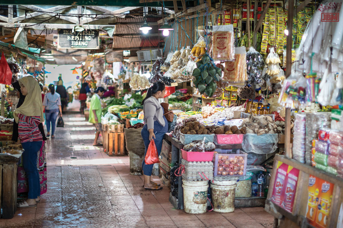
The merchants of Pasar Klandasan, each with their own little stall/shop beside an alley of the big market area, are uniformly good humoured, calm and polite.

They run their small-scale businesses with patience and quiet dignity. And they like to have a chat and a good laugh to pass time between customers.

It’s not an easy way to make a living. Many of the stalls are open before dawn, and they work long hours.

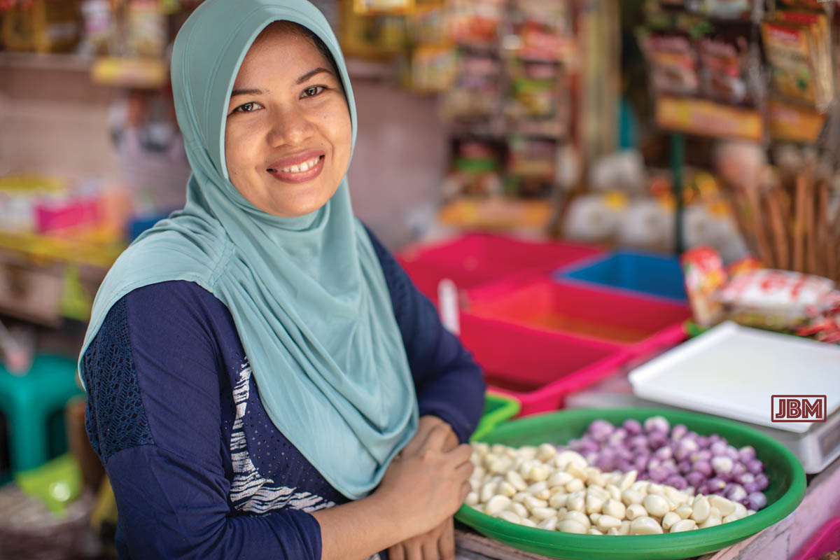
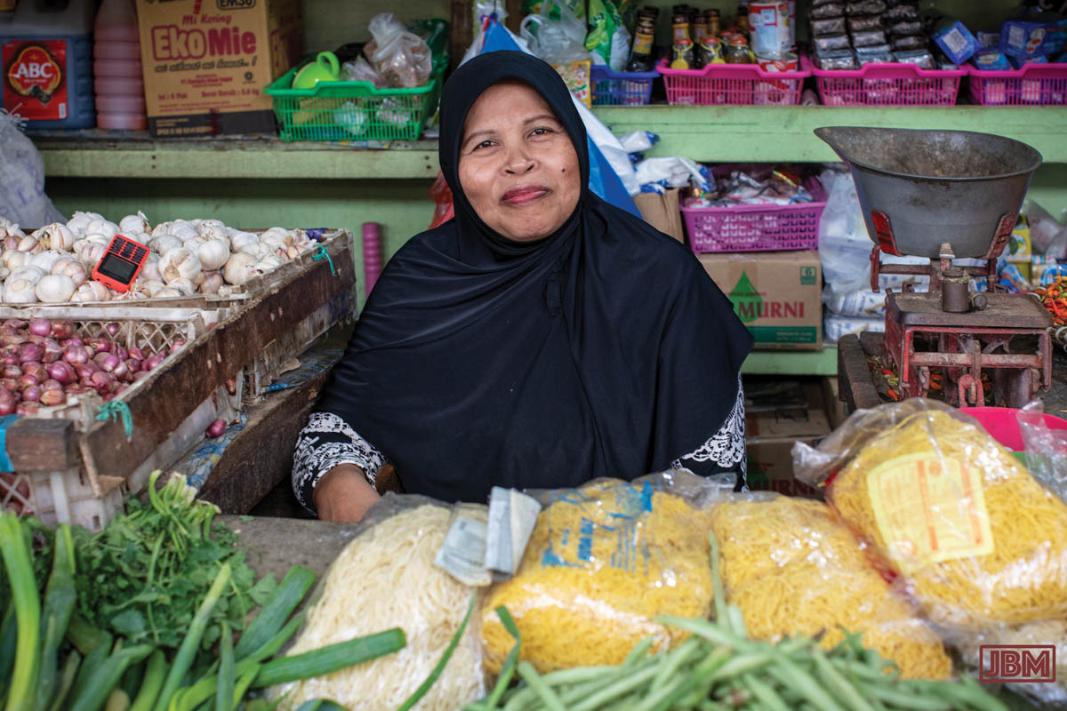
Mbak Etma sells a range of dried spices and herbs, as well as peeled cloves of bawang putih (garlic) and bawang merah (red onions or shallots).

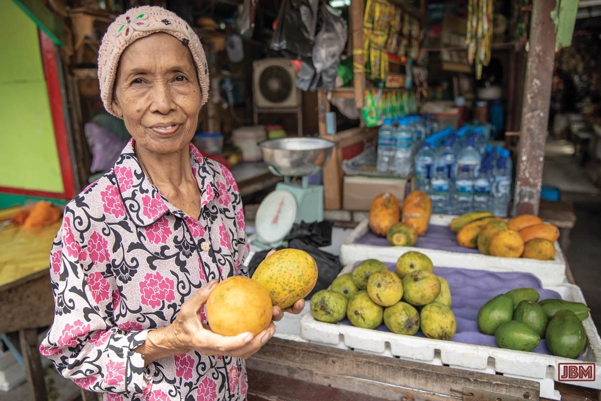
Most of the vendors lease their stall space from the actual owner, paying as much as Rp15,000,000 per year (approximately AU$1500) in rent for a lock-up stall in a good location inside the pasar. But even outside locations are expensive, and with mangoes at Rp10,000/kilo, they still need to sell a lot of produce to make a profit.

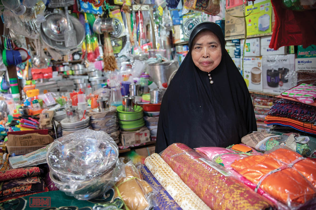
We bought a metal colander and a few plastic containers from Ibu Haji Parsini. It would be easy to completely outfit a kitchen from her compact little stall.

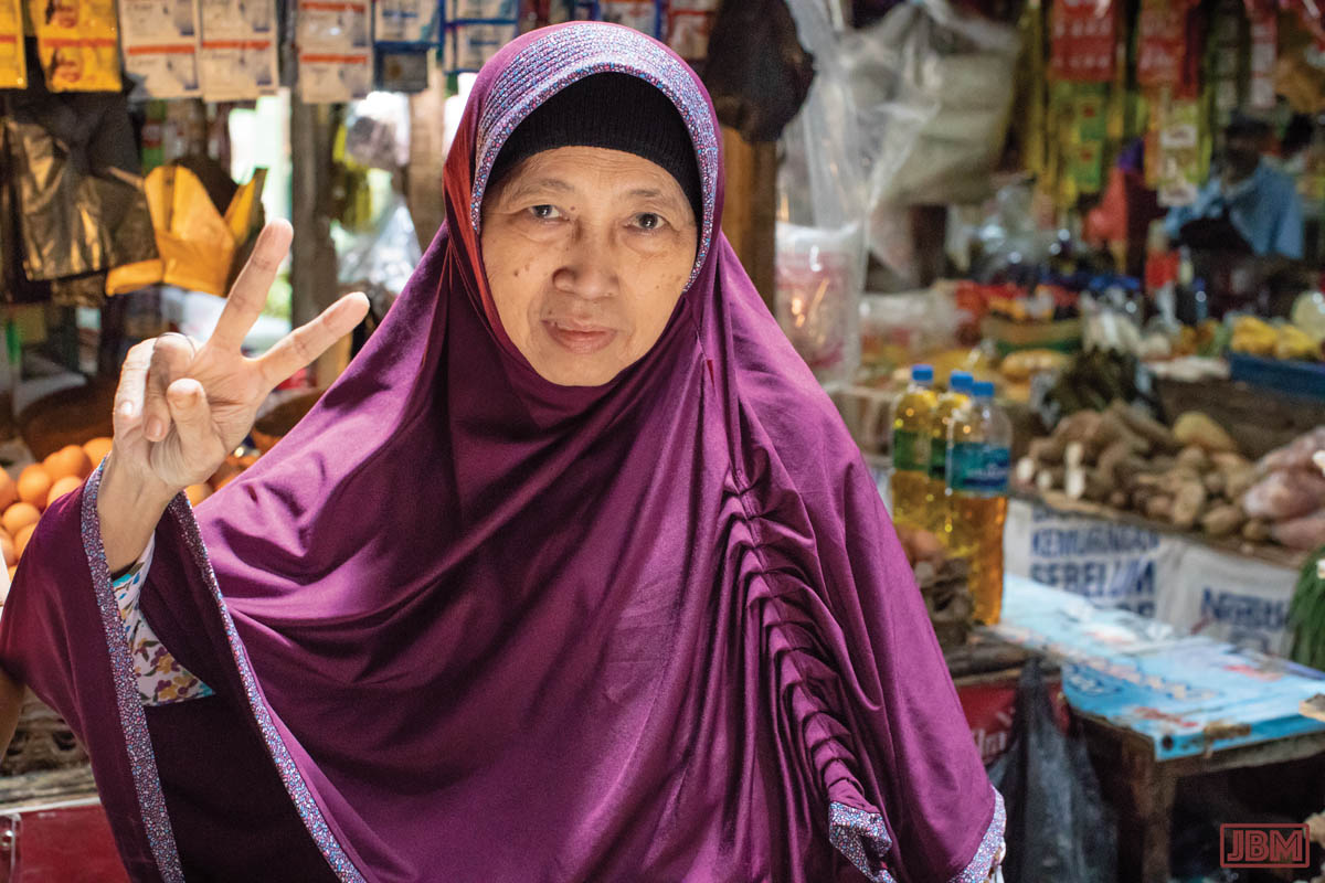
There was a major fire in central Balikpapan on 5 January, resulting in the destruction of hundreds of homes before the flames were extinguished. 67-year old Ibu Parsini was one of those who lost everything in the blaze.

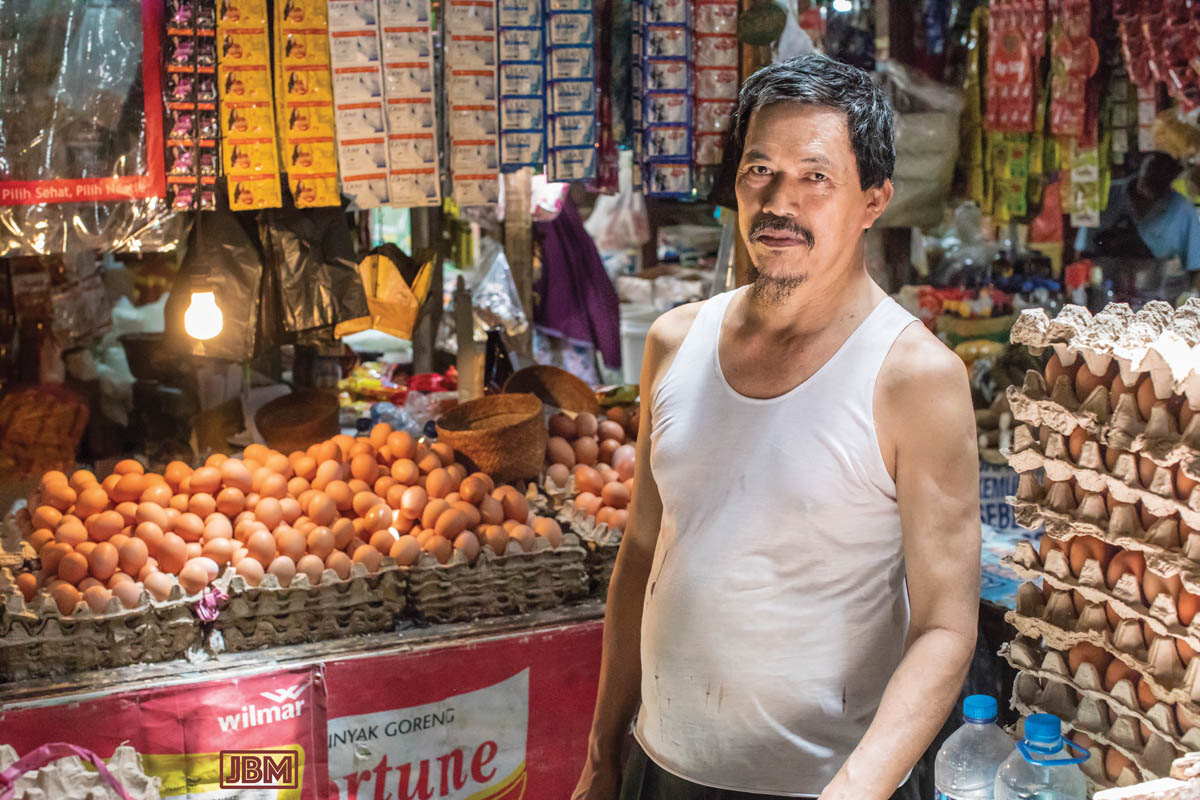
The eggs on sale in the Pasar Klandasan come over from Surabaya (East Java) by boat. There’s chicken eggs, duck and quail.

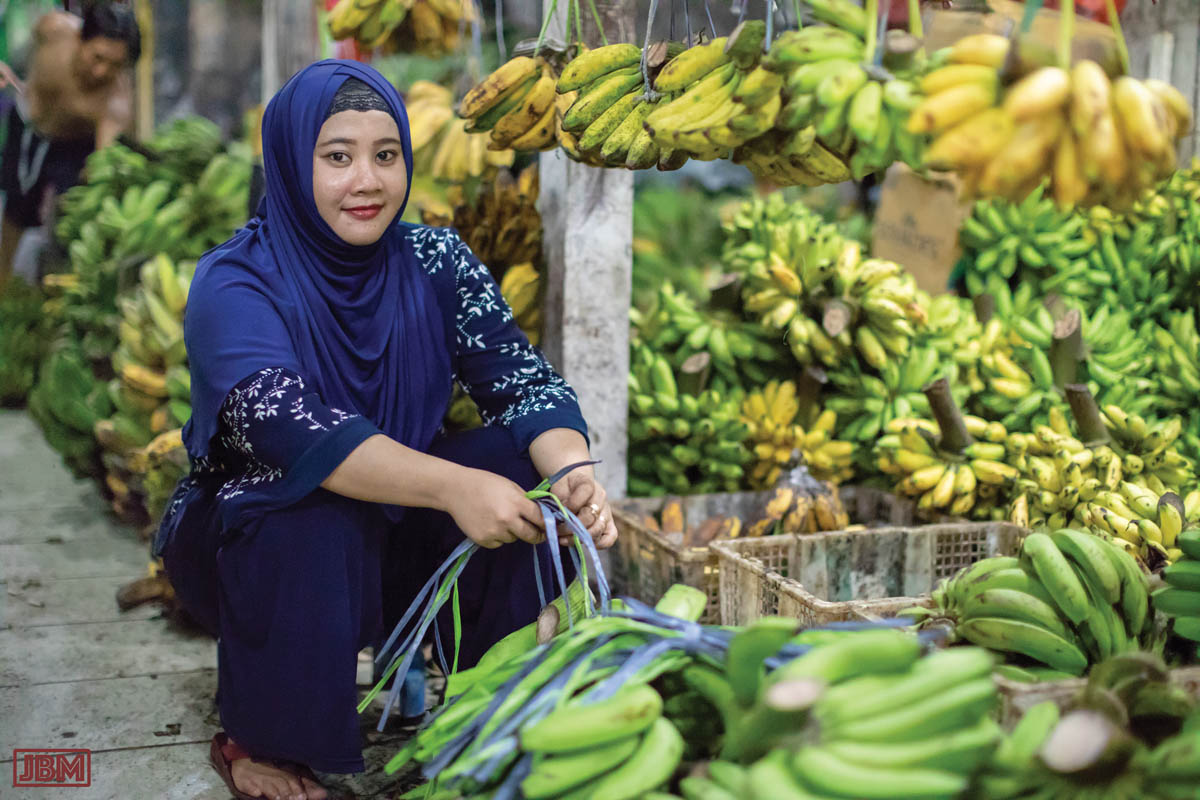
Unlike a supermarket, there are a number of different varieties of banana on sale. But most commonly available are pisang susu (‘milk bananas’) and pisang Ambon hijau (green Ambon bananas).

Ibu Janah prepares bunches of bananas to be hung on display.

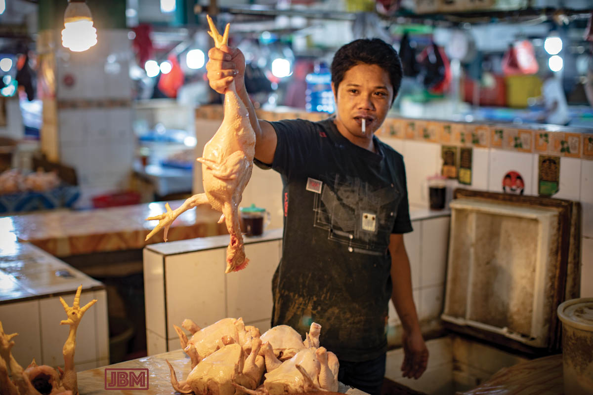
Vendors of fresh produce (especially meat, fish and leafy vegetables) have extra difficulties because, with no refrigeration at the Pasar, they have to carefully manage their own wholesale purchases so as to minimise spoilage and waste of unsold produce.

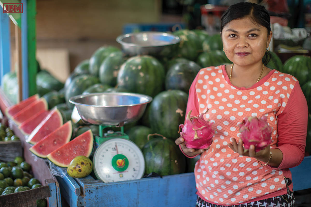
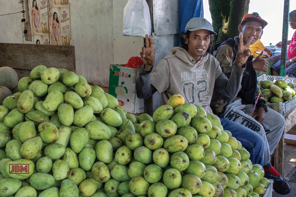
A lot of the fruit on sale is shipped in from other islands. But pineapples, dragon fruit, durian, salak, mangosteen and rambutan (amongst others) are usually locally grown.

Apples, pears, grapes are ‘imported’ from Java.

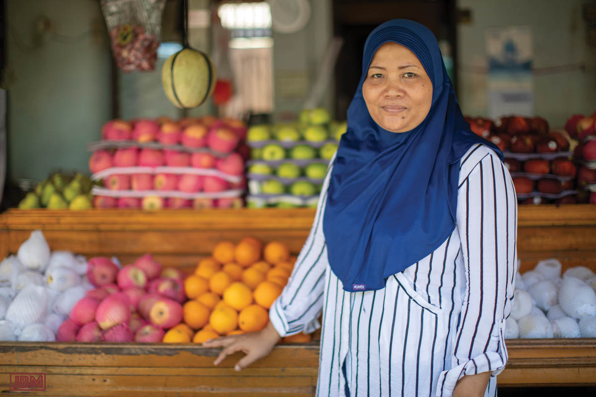
It’s quiet in the middle of the day at the Pasar, and Ibu was resting at the back of her little shop when we arrived. She was very willing to be photographed in front of her stall, once she had donned her jilbab.

Despite the absence of refrigeration, the produce is always fresh, the ‘wet areas’ of the market are clean and devoid of flies etc. There are no bad smells (other than the occasional cigarette…) Nearly all of our produce shopping is done at this market, and we’ve not had a day of illness.

In contrast, in the supermarkets of Balikpapan, of which there are now a number, the vegetables in particular are often so old, limp and unappetising-looking as to be unsaleable.

We got talking with Ibu Eka and Ibu Ferra, who have adjacent stalls near the main entrance to the market. They are both originally from South Sulawesi, though they didn’t meet until they had moved to Balikpapan. Like many people from Sulawesi (and other islands) they have moved here because the economy is relatively stronger.

It turns out that Ibu Eka’s kampung (home village) is at Danau Tempe, which by coincidence we may visit in June. She asked us to say ‘hello’ to her kampung.


Smoke gets in your eyes


Bukit_Batu_20141004_0007
It’s the tail-end of the Dry Season (Musim Kering) here in Central Kalimantan. Here (and in parts of Sumatra) it’s also known as Musim Kebakaran (‘the Burning Season’), because of the prevalence of man-made fires in the forest and farmlands. From piles of rubbish and raked-up leaves, to garden plots, scrubby farmlands, entire forests – it seems like the whole landscape is being progressively turned into smoke and ash. Even the ground is smouldering in places, because much of  it consists of dried-up peat swamp, often metres deep, and once fire gets a hold … it just keeps burning.

Marang_Idul_Adha_20141005_0090

The Dayak people have always used fire to clear small areas of forest in preparation for planting dryland rice and vegetables. But it was done on a small scale. Now everyone, not just shifting cultivators, is doing it. With much larger-scale cultivation of plantation crops (particularly oil palms), very large areas of both primary and secondary growth forest are being cleared, by chainsaw and fire. Indonesia has now overtaken Brazil as the ‘world leader’ in deforestation. And the fires have become an international issue, with Malaysia and Singapore complaining every year about the massive smoke clouds drifting over from Indonesia.

Tangkiling_asap_20141012_0020

Most, if not all of the fires are illegal, and national and regional governments regularly announce crack-downs, prosecutions and punishment of offenders. There’s even a website that uses high-res satellite imagery to give live updates of ‘hotspots’ across the archipelago. However, a just-completed independent audit of the 17 largest forestry firms in Riau found that none of them (not one!) managed even a 50% score for compliance with the regulations. Along the Trans-Kalimantan Highway which is our main road here (locally known as Jalan Tjilik Riwut), there is an anti-fire billboard every few hundred metres. They proclaim, alongside a picture of the provincial Governor: “Stop Fires! Protect forests and fields from damage”. There’ll often be a smoking or burning field behind the billboard.

Tangkiling_asap_20141012_0036

In Sumatra, the government has taken to handing out face-masks to passengers as they arrive at the airports. Here the Palangkaraya airport is often closed because the smoke is too thick for pilots to land their planes. Pre-schools have closed, and primary schools were all closed for two days last week. Vehicles drive with headlights on throughout the day.

Bukit_Batu_20141004_0011

We actually haven’t been affected too much by the smoke haze. It seems to have a cumulative impact on the health; some of the expats who have been here for the longest are suffering more than us, with several going to places with clearer air (like Bali – or even Jakarta!) for relief. Local people (by and large) don’t have that option, and so endure by being stoic.

We have air conditioning in our little house, and that helps a great deal. We also wear good quality masks when travelling on the motorbike, and when hiking. It has a certain ‘bandit chic’ about it, don’t you think? Nonetheless, we ARE looking forward to the arrival of the rains (probably within the next month), because that will spell the end of the Burning Season, and the end of the smoke…

Solo_20140823_0144

And, speaking of smoke, could it be that attitudes to tobacco smoking are changing? When we were here five years ago, I remember reading that 70% of adult men in Indonesia smoke every day (women almost never smoke), and that there were some 5 million people working in the tobacco industry (as growers, hand-rollers of kretek cigarettes, distribution and sales etc). That made the industry a pretty powerful lobby, and there seemed to be little push to reduce tobacco consumption. Now you can still buy and smoke cigarettes anywhere and everywhere, though the price has gone up to about A$1.60 per packet of 20 (i.e. around 10% of the price in Australia, often for the same brands). Advertising for cigarette brands is still seen everywhere (on billboards, shop banners, posters), often with those absurd Marlboro Man / James Bond / Racing Car images, and words like ’smooth’, ’taste’, ‘mild’, ’satisfaction’ and ‘fresh’.

But there doesn’t seem to be as many people smoking as there were five years ago, and cigarette packets now carry warning pictures – mostly Grim Reaper-style images, and some of the graphic diseased-tissue photos as on Australian packets. We hear people acknowledging the negative health impacts of smoking – five years ago there were people telling us that smoking is good for your throat and lungs! My work colleagues were joking recently about the foolishness of people who assiduously wear smoke masks all day, only taking them off in order to have a cigarette!

Turtle Nesting, Mallacoota

I find it useful to allow pictures to ‘cure’ for a time before deciding which ones I like. Sometimes the images that appeal most at first viewing don’t survive the passage of time and re-viewing. Too obvious, too garish, too shallow, too derivative – there’s a host of reasons why an image that at first seemed to be a ‘keeper’ later seems uninteresting. Or even embarrassing.

But others emerge from the archive after being neglected at first glance. Or else I find myself going back to look at them or work on them some more to try to reveal some hidden potential. Perhaps it is just that my taste changes over time.

Anyway, here’s a picture from March 2013 that I’d put in that second category – of emergent keepers. The scene was captured at Mallacoota on the ocean beach, on a hazy afternoon with pale sunlight filtering through sea spray.

Turtle Nesting, Mallacoota (2013)

Turtle Nesting, Mallacoota (2013)

I liked the man emerging from the surf in his white swimming trunks. As I worked on the image in Photoshop, I came to imagine him as some kind of amphibian creature arriving from the deep ocean, rather than just an ordinary bloke who’d gone out for a quick dip in the surf on a warm day.

I cloned him several times to create a ‘troop’ (a ‘flotilla’, a ‘school’?) of identical figures all reaching land simultaneously. The waves and the walking men give a nice strong feeling of movement from the right to the left side of the picture. It was late at night when I worked on the image, and I drifted into thinking of those high school science pictures showing the evolution of life as sea creatures started colonising the land. Then of some kind of aquatic zombie invasion. But mostly, I imagined sea turtles during their seasonal arrival to lay eggs in beach dune nests.

On the day when I first arrived at the headland and looked along the beach towards the inlet, the light and framing of the scene had me thinking of the quality of light in the beach photography of Massimo Vitali, whose work I had recently been looking at.

Massimo Vitali - Vecchiano Venditori, Italy

Massimo Vitali – Vecchiano Venditori, Italy

And later, when I came to work on the RAW file to produce the final image, I found more inspiration in the luscious, painterly beach images of Belgian photographer Harry Gruyaert. He has employed much darker tonality than the light-saturated, almost washed out images of Vitali (and my own picture). However I really like the stagey compositions, elevated angle of view and big skies, all accentuating the perspective of the beach stretching away to the horizon. (Click to see more of his work on the Magnum photo site)

Harry Gruyaert. Picardie region. Bay of the Somme river. Beach of the town of Fort Mahon. 1991.

Harry Gruyaert. Picardie region. Bay of the Somme river. Beach of the town of Fort Mahon. 1991.

The Turtle Nesting, Mallacoota picture was made as part of my project on South East Coastal Adaptation – you can see other pictures from the series at this link.

Future Landscapes VII: Flight

Pelican Flight

Pelican Flight

This image is a composite of two photographs. The background was taken inland from Merimbula, during a day of preventative back-burning. Dense smoke clouds emerged from many locations in the forest (part of the Southeast Forests National Park) and wafted over the treetops and nearby rural properties. There was a strong smell of smoky eucalyptus, and the atmosphere was lit with a glowing golden-brown haze. The pelican was photographed several hundred kilometres away (and several months earlier) in sunset light at Marlo in Gippsland. I processed both images with extra-warm white balance (about 6500oK), and applied some graininess to both images to accentuate the gritty sepia tonings.

I was thinking at the time of the impact of human intervention into the landscape, and the drastic changes that this has brought to the life of birds and animals of the region. I imagined the pelican fleeing the terror of the fire, and looking (accusingly?) out of the frame at the viewer. The same concept motivated the Echidna flight and Humpback flight images.

Echidna Flight

Echidna Flight

The background image depicts the Princes Highway near Merimbula, at the junction with the Yellow Pinch Road. It was taken in an autumn mid-afternoon, during burning-off operations in the adjacent forest. The light through the trees was filtered by the smoke, which also produced a hazy coppery light, almost (but not quite) like the warm light of sunset. The echidna was photographed a little before dawn (the following day), at Haycock Point in the Ben Boyd National Park, south of Pambula. Uncharacteristically for echidnas, he (or she?) seemed relatively unperturbed by my presence, and posed happily for some photographs before ambling away.

Like the Pelican flight image, this composite image was inspired by my thoughts of ‘wildlife’ fleeing from human disruption of their habitat. The massive size of this ‘mega-fauna monotreme’ is intended to suggest that it not just an individual creature, but is somehow representative of the species, or of native creatures in general.

Humpback Flight

Humpback Flight

A three-image composite. One of them – the background of ocean and sky – is itself based on another five separate images, combined as a high-dynamic range (HDR) image to give the scene a more dramatic, graphic sort of look. This was taken in early morning light in the Ben Boyd National Park. The ‘road’ is actually a wharf, extracted from a picture of the Edrom Point naval facility on Twofold Bay. Although humpback whales are seasonally prolific along the far south coast of NSW, I was in the region during autumn, when they are not around. So the whale in this image is one that I photographed in June 2012 in King George Sound, near Albany, Western Australia.

There can be few sights in nature as powerfully exhilarating as the sight of a breaching whale. After the near-extinction of many whale species during the 19th and 20th century commercial whaling, whale numbers are strongly recovering in the region. Twofold Bay was the site of a number of whaling stations, which operated until the last one (Davidson’s) ceased in 1929. Now the boats head out from Snug Cove at Eden for the purpose of watching (rather than catching) whales.

As with the other ‘Flight’ images (Echidna flight, Pelican flight) I wanted to allude to the disruption of habitat by human activity. In this instance the whale’s exultant launch into the air looks to be heading for a hard landing.

Future Landscapes VI: Eden Washovers

Edrom Wharf Washover

Edrom Wharf Washover

I’m not sure whether to view this image as a still frame from an over-the-top disaster movie, as a piece of subtle-as-a-sledgehammer environmental propaganda, or just as a visually interesting play on the fact that climate change will increase the likelihood of ‘washover events’ and coastal inundation as sea levels rise. In any event the small figures which can be seen at the far end of the road bridge should probably be running in terror from the approaching wave, rather than standing there casually fishing.

The road bridge is extracted from a photograph of the naval wharf at Edrom Point – the same one as seen submerged in Humpback flight. The wave was photographed at Depot Beach (north of Bateman’s Bay) where, when the swell is big enough and when the tide is right, the waves wrap around a small island off the headland and produce marvellous interference patterns as they collide.

Eden Washover I

Eden Washover I

Behind Aslings Beach in the town of Eden, a fairly low dune protects Lake Curalo and the lower parts of the town from inundation by the sea. If the dune were to be breached by the surf – which is more likely with rising sea levels and greater incidence of extreme weather events – one of the first areas to be inundated would be the sports field of the High School.

This composite image gives a fanciful vision of such a ‘washover event’, replacing the gentle lakeside view behind the football field with a turbulent set of ocean waves from Depot Beach.

The ‘Maritime Security Level’ sign, which I have relocated from the entrance to the Edrom Point naval wharf, assumes a new meaning for ‘security’.

Eden Washover II

Eden Washover II

The Eden Cemetery is located just on the town side of the Aslings Beach sand dune. It contains many graves from the 19th Century, the oldest known being from 1834. Some of the oldest graves now lie below the road which was constructed along the top of the consolidated dune.

The inscriptions are indicative of the difficulties of life for the early settlers and mariners of the region, with many drownings: “who departed this life at sea”, “died at sea on her passage from Launceston”, “my dear husband and children, drowned at Eden”.

If the Aslings Beach dune were to be breached by the sea in a ‘washover event”, the ocean could claim them for a second time. This composite picture imagines the lower parts of the cemetery under water, with fresh sand banks amongst the graves.

Future Landscapes V: Miscellany

Report and Reality

Report and Reality

The waters of Pambula Lake join with the ocean through a narrow inlet which runs between Pambula Beach and Haycock Point. There are large shell middens still clearly visible alongside the channel. In the pre-dawn light the still surface of the inlet, spotted with patches of seaweed showing through at low tide, looks as though one could walk across it.

I’ve overlaid the water surface with words and graphic extracted from the final report on South East Coastal Adaptation (SECA): Coastal Urban Climate Futures in SE Australia from Wollongong to Lakes Entrance: a map, a graphs of population projections for the region, arrows and words from the academic vocabulary in which the report is written (“Coastal Urban Futures”, “Time horizon”. The idea was to juxtapose the rhetoric of the report with the physical reality of the landscape.

The Garden of Eden

The Garden of Eden

Apart from its biblical importance, The Garden of Eden is a large caravan and camping park in Eden. This marvellously named establishment does indeed have a ‘Pets Welcome’ sign at its gate (though one wonders whether snakes would be admitted).

Inland from Eden, high up in the Southeast Forests along the Coolangubra Forest Road, a different kind of garden is seen in the extensive clearfell logging coupes. I’ve combined the two images to construct a dystopian vision of a paradise.

The green forest sign (“Woodchipped to promote sawlog growth”) has been transported from another, rather more healthy-looking forest location (alongside the Princes Highway), to add a touch of irony.

Future Landscapes IV: Fisheries

Fishery Sunset

Fishery Sunset

A large ‘hazard reduction’ fire was burning on the slopes of Mt Imlay, and a light southerly wind blew the smoke clouds up past Eden. As a result, the sunset light from the Snug Cove wharf was particularly spectacular, with light the colour of blood oranges.

I was on the wharf to photograph the trawlers and other boats moored there. This photo looks through the silhouetted masts of one of the larger trawlers towards the sunset. Superimposed on the sky are images of fish of the region, taken from a sign (at Quarantine Bay) which advises recreational fishermen of the size and bag limits for each of the various species.

Greenseas Cannery

Greenseas Cannery

The Greenseas Tuna Cannery operated at Cattle Bay in Eden for 50 years until 1999. Its closure by the owners (Heinz) was a serious blow to the community, as it had been the town’s major employer, and a ready market for the local fishing fleet. It’s now a derelict site, fenced off to prevent public access, with mostly just concrete slabs remaining, in a picturesque location beside the bay.

Into this setting (using 3D objects created in Photoshop CS6) I placed two large panels like advertising billboards, displaying images of the coastline at Pinnacles Point, in Ben Boyd National Park.

One picture conceals the ugliness of the remaining ruined factory building, while the other prevents us from seeing the ‘natural’ scene of the harbour behind. Perhaps the images are preferable to, or more desirable than, reality?

Future Landscapes III: Mallacoota Washovers

Mallacoota Washover I

Mallacoota Washover I

The base photograph for this image was taken in Mallacoota, looking across the Genoa River inlet towards the ocean. Large numbers of pelicans frequent the area, attracted in part by the fish cleaning benches at the public boat launching ramp. Two them are seen to be taking off, in their ungainly way.

The overlayed bridge appears to have been immersed by the waters of the inlet, suggesting this to be a flooded place of human occupation.

Mallacoota Washover II

Mallacoota Washover II

At the Mallacoota Inlet, a complex system of sandbanks defines the passage of the Genoa River as it reaches the ocean, near the conjunction of Bass Strait with the Tasman Sea. At low tide the shallow platforms of sand emerge from the waters of the Inlet.

In this image I wanted to transform the view from a tidal landscape to a scene suggestive of future inundation, by placing a semi-derelict building and surrounding garden plants onto the sandbank. Surely it will be immersed by the next high tide. A lone figure with a small boat is seen departing – perhaps salvaging some last possessions?

The little building was actually photographed in a (dry) paddock alongside the road out to Pambula Beach in NSW.

Ghost Gums

Ghost Gums

The base photograph was taken in early morning light at Mallacoota, looking westwards across the waters of the inlet.

The photograph of the ‘ghost gums’ was taken along the Broadaxe forestry road through the Southeast Forests, near the Victorian border.

These trees, seen below the water of the inlet appear impossible – credible neither as a reflection or a submersion of a real forest. The perspective is ‘wrong’ in a way that disrupts the viewing of it as a conventional landscape. I wanted the image to evoke a mood with equal measures of serenity, melancholy and strangeness.